What if a long-abandoned railroad right-of-way could become both a weekend escape and a serious environmental repair job? Northern California is now moving closer to finding out after the Great Redwood Trail Agency approved a master plan for the Great Redwood Trail, a project that aims to run from San Francisco Bay to beyond Humboldt Bay.
The headline is recreation, but the deeper story is infrastructure. The plan frames the trail as an ecological restoration effort first, and it is backed by an assessment that estimates more than $102 million per year in combined recreation, health, and transportation benefits across the 231-mile northern portion, while warning these figures are not precise predictions.
What the approval actually covers
The newly approved master plan focuses on 231 miles in the northernmost three counties Mendocino, Trinity, and Humboldt, within a larger 300-plus mile corridor that winds through five Northern California counties.
The agency says the corridor will range from narrow backcountry stretches to wider paved multi-use segments, which matters if you are picturing anything from hiking boots to bike commutes.
Essentially, this is a “piece by piece” build. The master plan breaks the route into 43 segments, and the agency points to extensive public and Tribal engagement that helped shape how those segments are prioritized and managed.
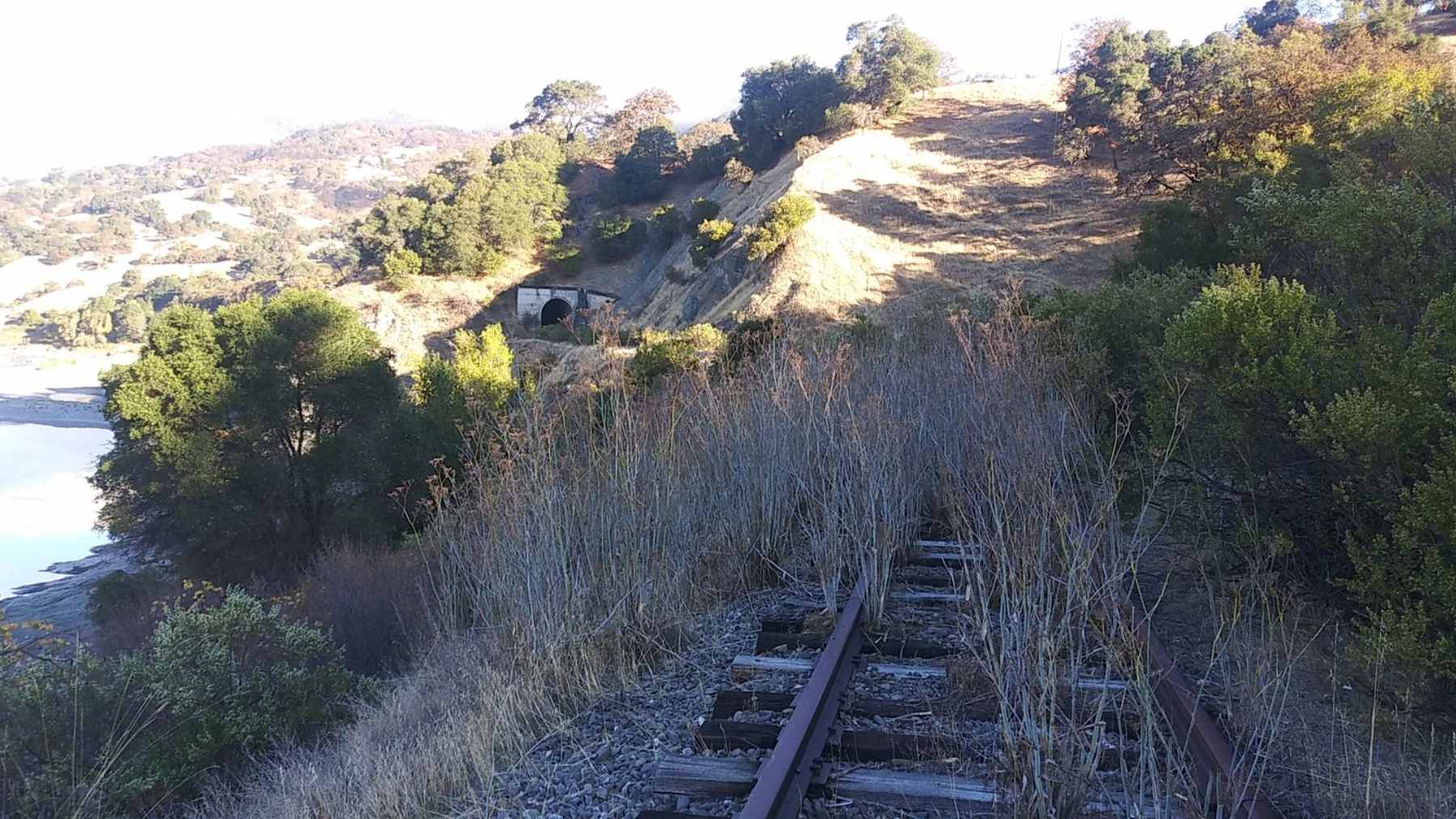
A trail built as a cleanup project
One of the most important lines in the agency’s own announcement is easy to miss. It says that transforming neglected properties tied to the former Northwestern Pacific Railroad will involve removing hazardous materials, stabilizing damaged slopes, restoring wildlife corridors, and improving habitat for riparian species including steelhead and salmon.
Agency leaders are also leaning into that framing publicly. Board chair Mary Sackett described the effort as “transforming abandoned rail and ecological damage into restoration and beautiful trails,” while Blue Lake Rancheria Tribal Chair Jason Ramos called the project “a critical opportunity to restore fish habitat” and protect cultural resources.
The business math behind trail towns
The economics are already being debated, and the numbers are big enough to get attention. A 2023 economic benefits assessment for the 231-mile northern section estimates total annual benefits of about $102.568 million in 2023 dollars, led by recreation, tourism, and retail benefits, plus sizable health benefits tied to walking and cycling.
But there is a crucial caveat that keeps the conversation grounded. The report says impacts are “order of magnitude” estimates, and it assumes the trail is fully built and has had time to establish regular use.
The demand is real, but it is not evenly spread
The same assessment estimates 6.2 to 9.2 million annual trips across the 231-mile northern alignment, with daily averages of about 2,500 to 3,600 bicyclists and 14,500 to 22,000 pedestrians. It also anticipates that roughly one-third of trips could be from visitors, which is where the “trail town” business case really kicks in.
Those visitor dollars add up in familiar ways. Using spending patterns from comparable trails, the report cites average non-local group expenditures of $64 for food and meals, $60 at retail, $31 for entertainment, $52 for bike rental, and $93 for lodging. That is the kind of mix that shows up in local storefronts, not just in tourism brochures.
Engineering and tech behind the scenes
It is tempting to picture a simple rails-to-trails conversion, but the corridor runs through terrain that does not always cooperate.
A State Coastal Conservancy staff recommendation notes that parts of the right-of-way include rail bridges, trestles, and tunnels, “some of which have collapsed,” and it flags erosive geology and deferred maintenance as real challenges that require systematic planning.
That is where the less flashy “tech” story lives. Planning work includes geotechnical studies with landslide analysis, cultural resource investigations, and biological surveys such as wetland delineations and threatened species surveys, along with identification of ecological restoration opportunities that can be built into design.
Energy and security questions are starting to follow the corridor
One detail from a 2024 agency board meeting hints at how multi-use a continuous right-of-way can become.
The minutes describe an initial study by the California Energy Commission and the Schatz Energy Research Center at Cal Poly Humboldt to assess rights-of-way for locating electrical lines for a proposed wind farm outside Humboldt Bay, with interest in analyzing the agency’s corridor as part of that conversation.

Nothing in that note says the trail will automatically become a transmission corridor. Still, it shows why projects like this can attract attention from the clean energy sector and from public agencies that think in terms of resilience and critical infrastructure, not just recreation.
Why first responders have a seat at the table
If you are wondering why a trail plan would involve public safety stakeholders, the agency’s own engagement list gives a clue. It says the project team held more than 70 stakeholder meetings that included law enforcement and first responders, alongside businesses, environmental advocates, and other local groups.
Federal transportation research backs up the broader idea that trails can matter during disasters. A Federal Highway Administration white paper reviews how trails can serve as evacuation routes and support emergency response, and it notes that trails can also aid wildfire management by providing access for ground crews and by helping planners think about fuel breaks.
What happens next on the ground
The plan’s approval does not mean a single ribbon cutting. It means the agency can move through grants, environmental review, and design segment by segment, which is why locals are already seeing progress in specific places.
A 2025 agency project update lists construction underway on a 1.9-mile rail-with-trail segment in Ukiah and a 1.6-mile segment in Willits, both expected to be completed in 2026, plus a 3.3-mile Arcata Annie and Mary Trail connectivity project expected to run from late summer 2025 through the end of 2026.
The press release was published on The Great Redwood Trail Agency.