If you’ve ever chased a “scenic route” on your phone and ended up staring at brake lights, you already know the truth. Nature is the draw, but access is the choke point.
That’s why the Beartooth Highway matters right now. This 68-mile climb into the Northern Rockies is still one of America’s great drives, but it’s also becoming a real-world test of climate pressure, tourism demand, and the technology we depend on when conditions flip fast.
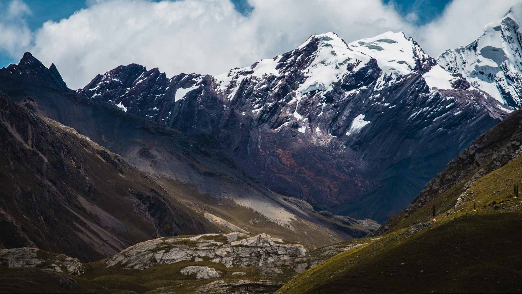
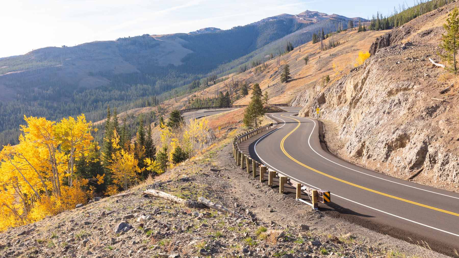
A 68-mile gateway built above the treeline
The Federal Highway Administration lists the Beartooth Highway as an “All-American Road” that runs through Montana and Wyoming, stretching about 68.7 miles. It’s not just a connector to Yellowstone’s Northeast Entrance, it’s marketed as the destination itself, with dramatic views and “unparalleled wildlife watching.”
The climb is part of the legend. Travel + Leisure reports that drivers gain about 2,800 feet of elevation, topping out at 10,947 feet at the Beartooth Pass overlook, while the U.S. Forest Service warns the route is often windy and can take two to three hours before you’ve even stopped for photos.
That altitude also makes the calendar fragile. Yellowstone’s own road guidance says Beartooth Highway generally opens the Friday of Memorial Day weekend and runs to mid-October, but “after initial opening, weather causes occasional closures.”
Wildlife moments that come with rules
Part of what makes the drive feel like a nature documentary is how quickly the landscape changes. “There is really nothing like the Beartooth Highway,” says Red Lodge shop owner Marci Dye, pointing to the multiple ecosystems that stack up from valley to high tundra.
But those pullouts can turn into something else in peak season. Yellowstone’s safety rules are clear for a reason, requiring at least 100 yards from bears, wolves, and cougars, and 25 yards from all other wildlife, and it notes that binoculars and telephoto lenses beat walking closer every time.
There’s also a hidden environmental cost when crowds push the limit. The park warns that feeding wildlife can make animals aggressive and they “have to be killed,” which is a grim reminder that one careless snack toss can echo far beyond a single trip.
Climate volatility is changing the “best time to drive”
Locals still point to midsummer as the sweet spot, mostly because it’s the safest bet for open pavement. Dye told Travel + Leisure that June and September can bring snow closures, and that the weather can be “very unpredictable,” even when it feels like summer down in town.
Zoom out and the trend line gets harder to shrug off. Yellowstone’s climate change information says scientists are documenting major shifts in snowfall and in the timing and intensity of spring runoff, while warmer temperatures reduce snowpack and wildfire seasons expand in severity, frequency, and size.
For nearby businesses, that unpredictability hits like a fluctuating paycheck. Yellowstone reported 4,762,988 recreation visits in 2025, plus 86,891,452 visitor hours and 1,238,983 overnight stays, which tells you how much economic activity is packed into a limited season.
Tech helps, but the basics still win
When conditions change quickly, official channels matter more than a glossy route preview. Yellowstone’s road page tells travelers to check locally and to use Wyoming and Montana transportation resources before driving, and Montana’s 511 service offers statewide road conditions by web and phone.
The awkward part is that your favorite tools can be weakest where you need them most. Yellowstone says cell service is “extremely limited” and that summer demand can overwhelm circuits, and the park also cautions that EV charging is “extremely limited” inside Yellowstone with no public chargers due to remoteness, aging infrastructure, and electrical capacity.
That’s where quieter, less flashy tech shows up. Yellowstone has described fiber optic and telecom upgrades aimed at improving communications that support “critical park operations, safety and emergency services and visitor information” in developed areas, which is the unglamorous backbone behind modern park management.

The defense connection is closer than it sounds
It’s easy to treat a scenic highway like a leisure story only, until a storm closes a high pass and the ripple spreads. Road access in the Rockies affects evacuation routes, emergency response timing, and the ability to move resources fast when wildfire or extreme weather hits.
The Pentagon has been increasingly explicit that climate is part of resilience planning. The 2022 National Defense Strategy says the Department will make supporting systems “more resilient and agile” in the face of threats that include the effects of climate change.
Budget documents show the same mindset in practice, including funding aimed at incorporating climate risks into exercises and planning tools and supporting disaster response missions. In plain terms, the instability that can shut down a tourist corridor is also the kind of instability defense planners train around.
What to keep in mind before you go
If you’re thinking of using Beartooth as a quick add-on, local guide Akio Joy has a simple warning. “The biggest mistake would be trying to squeeze in the pass before or after an epic day in Yellowstone,” he told Travel + Leisure.
Plan for the mountain to feel like a different planet than the valley, and follow the wildlife distance rules even if everyone else is inching forward. Yellowstone notes that it’s illegal to remain near wildlife in a way that disturbs or displaces an animal, and that’s a line that gets crossed faster than people realize when the phones come out.
Check conditions on official road tools, expect limited signal, and leave extra time for the slowdowns that come with real wilderness access. The payoff is still there, but preparation is part of the ticket.
The official statement was published on National Park Service.